 Colouring Nest
Northeast States Map
- Ages 7+
- Medium
- 2 pages
- Worksheet
- Answer key
- PDF: Letter & A4
- Updated


Tip: download the PDF for Letter or A4 paper, print it at 100% and use a pencil or crayon. Tap "Show solution" to check your answer, or print it as an answer key.
Up nextMidwest States Map →Advertisement
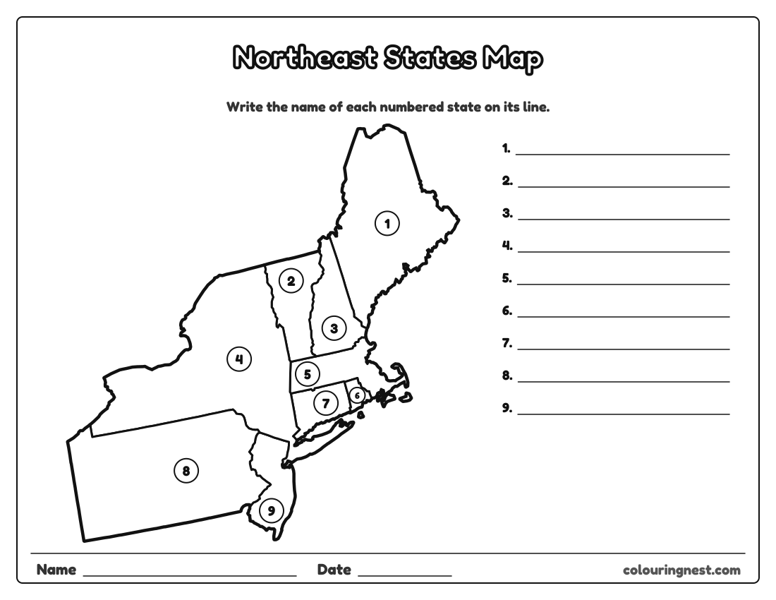
The nine states of the US Census Bureau’s Northeast region, drawn large on one page: Maine, New Hampshire, Vermont, Massachusetts, Rhode Island, Connecticut, New York, New Jersey and Pennsylvania. Each state has a number, counted from north to south, and the lines on the right are for writing its name. Rhode Island and Connecticut are far easier to see here than on a map of the whole country. The answer key is on page 2.
Also try: Midwest States Map · Southern States Map · Western States Map
States of the Northeast
The answer key lists them in the order of the numbers. In alphabetical order: Connecticut, Maine, Massachusetts, New Hampshire, New Jersey, New York, Pennsylvania, Rhode Island, Vermont.
- Write the names you are sure of first, then use neighbours as clues.
- Check your answers with page 2, or tap “Show solution”.
- Then try the whole country with the 50 states quiz.
The other regions: Midwest, South, West. See all blank US maps.
For teachers and parents
- What it practises
- US geography: the 50 states, state names, abbreviations and capitals, reading a map
- How to use it
- Study with a labeled map first, then test with the blank map or a quiz. Learn one region at a time. Answer keys are in the PDFs.
- Time
- About 10–20 minutes
Advertisement
More blank us maps


Collections: Free Homeschool Printables
You might also like


Printing tips
- Print at 100% so small states like Rhode Island stay clear.
- Learn one region at a time with the regional maps.
- Check quiz answers with the answer key page.
Advertisement