 Colouring Nest
US Map with State Names
- Ages 7+
- Medium
- 1 page
- Coloring page
- PDF: Letter & A4
- Updated


Tip: tap a colour, then tap any shape to fill it (or use the arrow keys and Enter). Your colouring is saved on this device automatically. To colour on paper, download the Letter or A4 PDF and print it at 100%.
Up nextUS Map with State Abbreviations →Advertisement
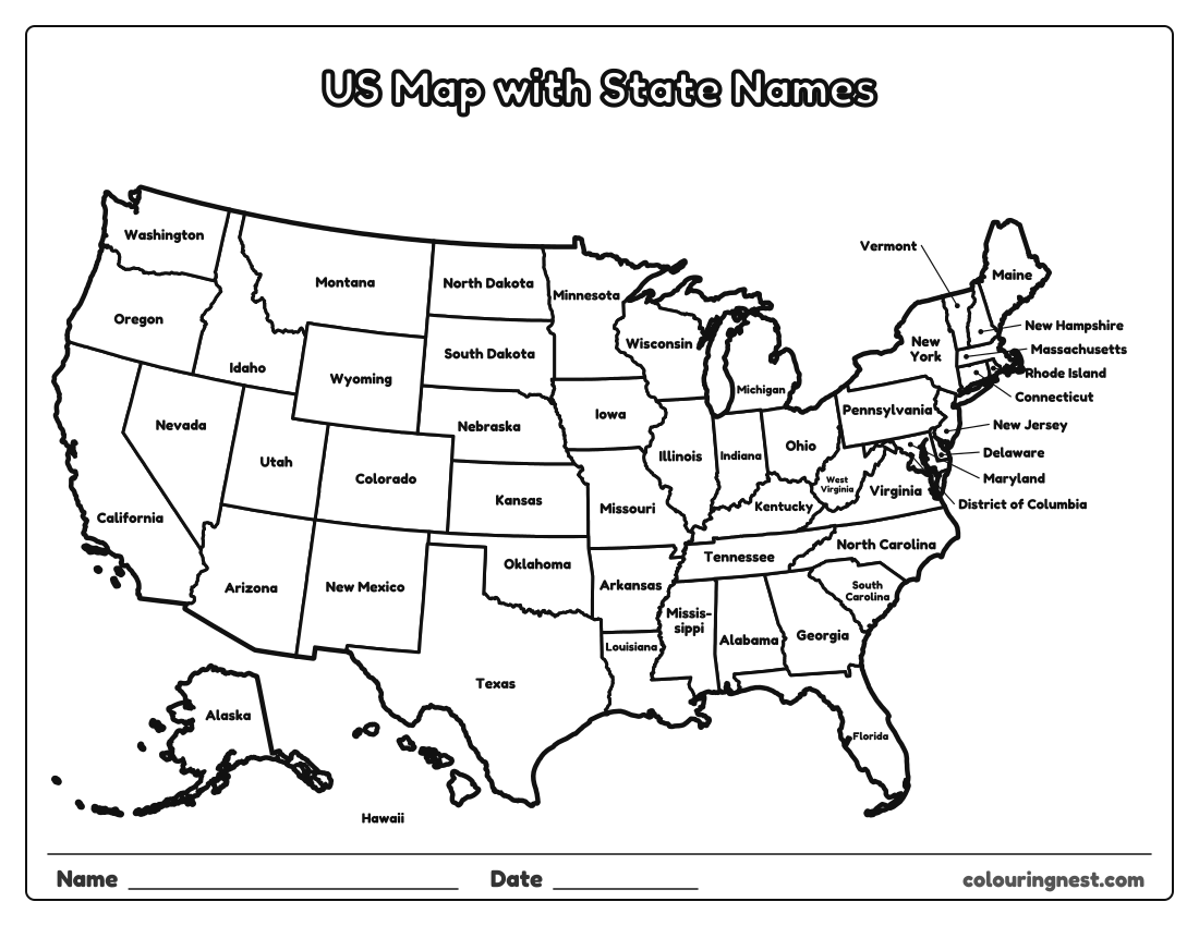
A labeled map of the United States with the name of every state written inside it. Where a state is too small for its name (Vermont, New Hampshire, Massachusetts, Rhode Island, Connecticut, New Jersey, Delaware and Maryland, plus Washington, D.C.), the name sits in the margin with a line to the state. Use it as a reference beside the blank map, to study for a states test, or to color in online.
Also try: Blank US Map Quiz: Name the 50 States · US Map with State Capitals · States and Capitals Quiz
Learning the states with this map
- Learn one region a week with the regional maps, then come back to the whole country.
- Cover the map, name a state, and point to where you think it is.
- Find the states that touch the most others: Tennessee and Missouri each border eight.
When you know them, test yourself with the 50 states quiz. See all blank US maps.
For teachers and parents
- What it practises
- US geography: the 50 states, state names, abbreviations and capitals, reading a map
- How to use it
- Study with a labeled map first, then test with the blank map or a quiz. Learn one region at a time. Answer keys are in the PDFs.
- Time
- About 10–20 minutes
Advertisement
More blank us maps


Collections: Free Homeschool Printables
You might also like


Printing tips
- Print at 100% so small states like Rhode Island stay clear.
- Learn one region at a time with the regional maps.
- Check quiz answers with the answer key page.
Advertisement